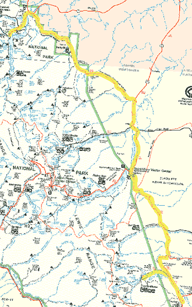
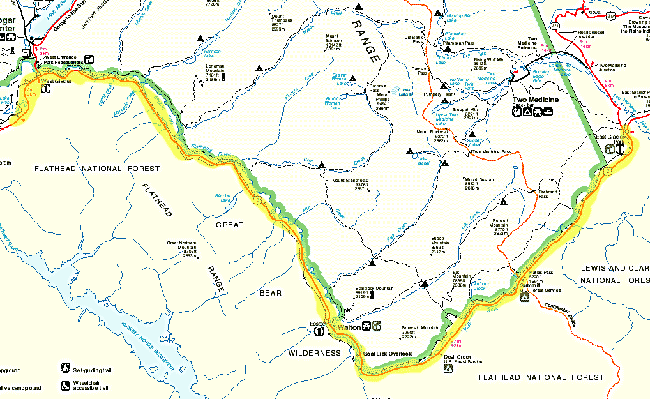
Day 5 route map -- 65 miles (out of a potential 88)
 |
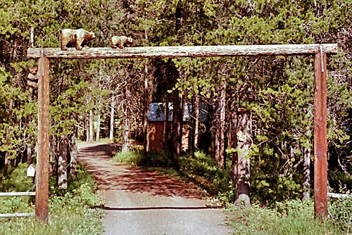
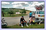
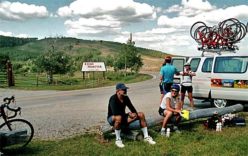
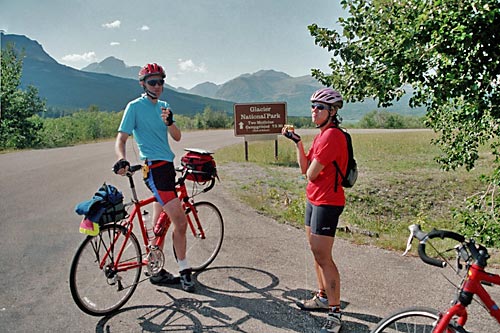
Greater Metropolitan Babb |
The first half of today's ride was re-tracing our route back from Canada until we got to St. Mary's Lake in Montana again. We "cheated" first thing in the morning by taking the van shuttle up the huge hill outside Waterton Park -- who needs 4 miles at a 10% grade first thing in the morning? Everyone except for three people on the trip was in the van with us.
 |
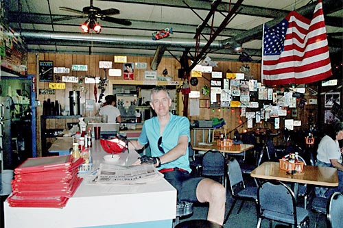
Two Sisters Cafe |
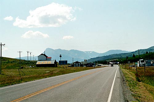
There were still plenty of hills left to do the rest of the day. We passed Chief Mountain again, and then we made our THIRD trip through greater metropolitan Babb, Montana, which was comprised of about eight buildings spread along the highway. But they had great civic pride.
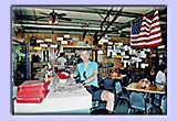
We also stopped in the "famous" Two Sisters Cafe where Mark sampled the rhubarb pic (and pronounced it excellent). The address of the place is "near Babb."
Then it was
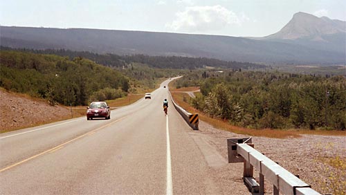
back on the long road again to St.Mary's. Essentially we were skirting along the eastern edge of Glacier Park most of the day. At this point, to the right was the fantastic mountainous landscape of the Park, and to the left was the open nothingness of the Blackfeet Indian Reservation. Soon we would pass entirely into the reservation and be surrounded by nothingness.
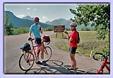
 |
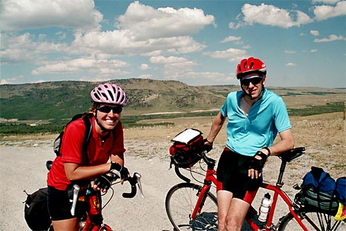
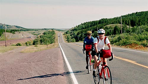
Mark & Jenn in Big Sky Country |
At St. Mary's, after lunch, Carrie shuttled us in the van again (gasp!) up a seven mile hill into the Blackfeet Reservation. When we got to the top it truly felt like Big Sky country --
where the van dropped us off there was nothing to see for miles around. Jenn was riding with us for this section of the ride (it seems we had dropped behind the others, which is why we took the van shuttle.) After many miles of rolling hills through this wide open space we came to Kiowah, where we had a break where snacks were available and the van was there to fill up water bottles.
 |
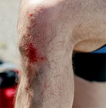
A well-deserved break |
Mark forgot for a moment as he was stopping that he had clipless pedals, fell over, and
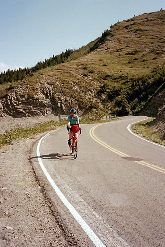
sustained a "life-threatening" (as he put it) injury. We hung around at Kiowah for a while, not anxious to get back on the bikes because after this was another four mile climb. No van shuttle for us this time. Eventually we accepted the inevitable and left for
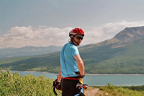
the climb and did what we had to do. After we reached the top there was a great long twisty downhill through a forest to make it all worthwhile. At the bottom
Mark posed for a photo with the dramatic scenery behind him.
 |
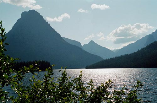
Back into the Park to
Two Medicine Lake |
Soon after the bottom of the downhill was a turn-off back into Glacier Park and to an area known as Two Medicine Lake. It was a seven mile detour to Two Medicine Lake, but the van would be waiting for us there.
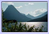 |
Two Medicine Lake |
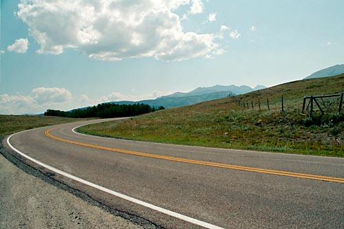
It was a beautiful ride there, with the exception of the two mile hill at the end that none of the leaders bothered to mention was ahead.
I'm not sure if anyone would have gone had we known...
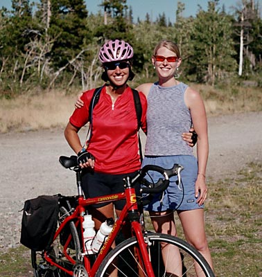
At Two Medicine Lake there was a beautiful view and a good souvenir shop that we all descended on. Then we hung around for a while at the Lake --
Jenn and Carrie posed for a photo. When the van left we took our third shuttle for the day (what's this world coming to?), since 65 miles felt like enough for the day, although it was less than ten miles (including the hill we had just come up) to Glacier Park Lodge, our digs for the night.
 |
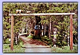
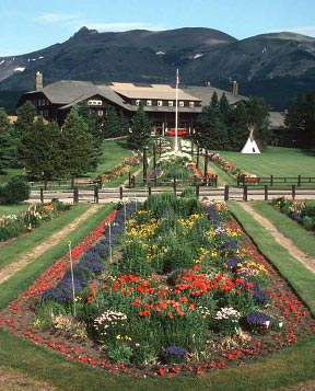
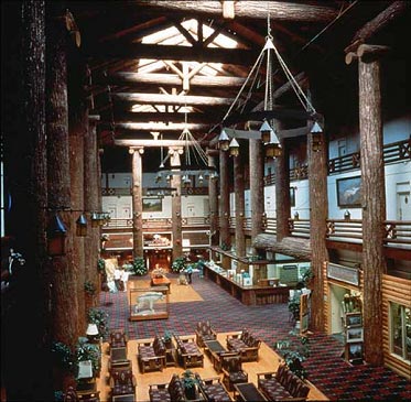
Glacier Park Lodge |
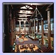 |
The Tree Lobby |
We arrived at Glacier Park Lodge shortly after. Built in 1913, this was one of the first lodges in the Park, located next to a railroad station which was the original way that visitors were brought in by the Great Northern Railway. While the setting may not have been quite as spectacular as some of the other lodges, the lobby was absolutely amazing -- those are all real trees surrounding the room (unfortunately, the rooms were no better than any of the other lodges). That night we had our farewell dinner at a nearby Mexican restaurant celebrating all our accomplishments. The margaritas were flowing the whole evening.
Day 6 -- From East Glacier back to West Glacier over Marias Pass
Day 6 route map -- 58 miles
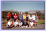 |
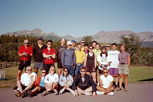
The Group |
First thing in the morning we posed for our group photo and then we were on the road again. Our final destination was near where we had started off in West Glacier. Today we would be skirting the southern edge of the Park, and crossing Marias Pass, the second crossing of the Continental Divide on the trip (the first being Logan Pass at the top of Going to the Sun Road on the second day).
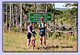 |
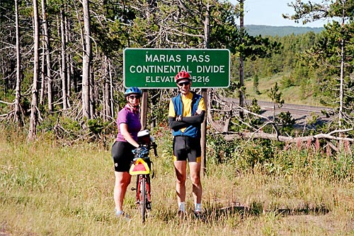
At Marias Pass |
Fortunately, this pass was nothing like the ride up to Logan Pass.
In fact Marias Pass played a major role in the history of developing the west because it was the first (and only) pass across the Rockies that is railroad grade (meaning not more than 3%), so that the railroads could be built going further west.
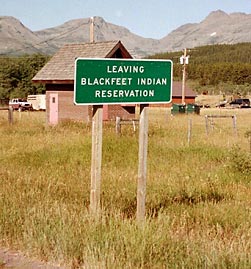
The good news for us meant that while it was several miles up to the pass, it was not steep, so it was no big deal. Soon after we got on the road we saw a sign indicating that we were
leaving the Blackfeet Nation lands, which we had been riding on for several days of the trip. We then started the climb up. After so many steep long hills on this trip, this was a piece of cake.
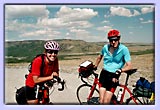
Here are Paula and Ray reaching the pass -- note the railroad lines to the left, which actually followed our route the entire day.
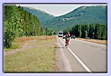 |
It's all downhill from here... |
After Marias Pass it was almost all downhill the rest of the day, which was a welcome relief. An occasional hill broke up the monotony of hardly pedaling! We stopped for a
Backroads picnic lunch at the historic Isaac Walton Inn, which was originally built to house the people working on the railroad over Marias Pass.
 |
 |
Some local color. |
We continued on skirting the park until we reached West Glacier. Some local color along the way:
And that was it! We finished the trip at a campground outside West Glacier, everyone going off their separate ways. However, most of us were staying the night in the town of Whitefish, Montana, so we made plans to get together that evening for dinner as a group one more time.
For more information on this bike trip or other "epic" bike trips by Backroads, visit their website at
www.backroads.com.

The Day After -- Whitefish back to Spokane
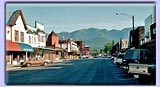 |
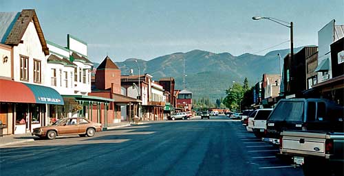
Main Street Whitefish |
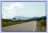
We stayed the night at the most delightful B&B in Whitefish, called The Garden Wall, a few minutes from the main street in town. We had some time in to look around town in the morning. It was a classic town of the old west-- you could easily imagine horses being the primary mode of transportation on the main street, except of course for the huge ski area (Big Mountain) looming in the distance.
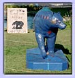 |
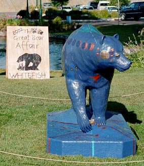
The Great Bear Affair |
As a bonus, there was an exhibit called "The Great Bear Affair" going on, similar to the Cow Parade previously in Chicago, New York and elsewhere -- many bear sculptures decorated in very creative ways by a number of artists, some of them quite clever.
 |
Click here for a slide show of some of the creatures in the Bear Affair. |
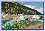 |
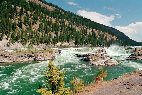
Kootenai Falls |
Then we were on the road again, this time by car, for a five-hour drive back to Spokane via the beautiful countryside of northern Idaho, stopping for a short walk to see Kootenai Falls, and for ice cream (and a quick look around the Coldwater Creek factory store) in Sandpoint, Idaho. Soon we were back in Spokane and on our plane home. A quick week in the magnificent west.
Montana
Page 1 |
Page 2 | Page 3

