The next day was the round-trip to K2 Base Camp. This was the ultimate goal of the trek, but it was an optional hike, and some opted to stay at camp and relax. Probably wise. It was a gruelling 12 hour-plus day.
 |
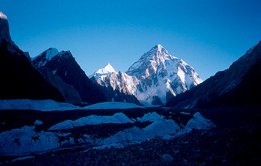
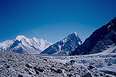
K2 at Dawn |
Wake up calls were at 4 a.m. We left at five. It was freezing cold. And dark. The first thing we had to do was cross over the difficult terrain resulting from the meeting point of the Baltoro and Godwin-Austin glaciers. Rock scrambling and other tricky bits, tough at that hour of the morning. After the first hour the terrain became much easier, and in three hours we arrived at Broad Peak Base Camp.
 |
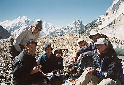
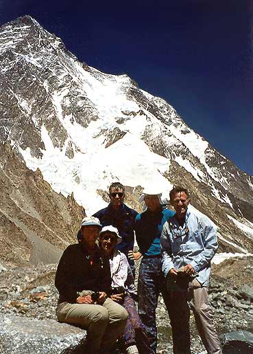
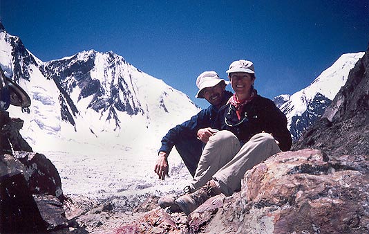
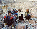
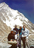
Broad Peak Base Camp |
This is the group at Broad Peak Base Camp (plus Hillary who was taking the photo). Of the eight of us, only five continued on to K2 Base Camp. The best views of K2 were from Broad Peak anyway. FYI, there is not much to a "base camp." If the porters didn't tell us we were there, we wouldn't have known. The only distinguishing features from the rest of the rocky terrain are the presence of stone circles that the porters use for shelter in camp. When there's an expedition there, a base camp is a small city; any other time, it's just a spot on the map.
 |
 |
 |
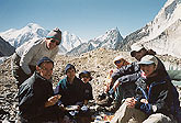
Porters who guided up to K2 Base Camp |
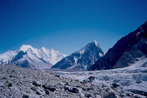
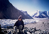
Looking back towards Concordia from Broad Peak |
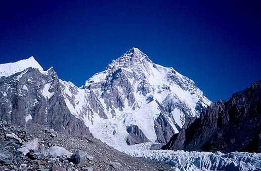
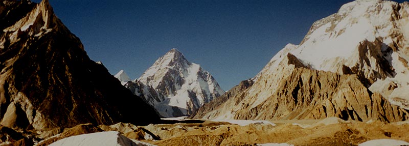
K2 from Broad Peak Base Camp |
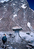 |
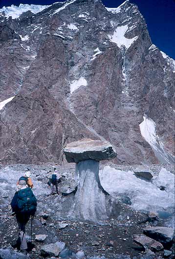
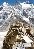
More "Mushrooms"! |
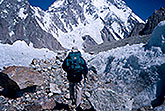 |
To Base Camp through the ice tunnel |
After about an hour's rest, the smaller group continued on to K2 Base Camp. We did this at a somewhat breakneck pace, making it in an hour and a half (it usually takes at least two hours), not taking a rest for the first hour. The walk was not too difficult and it was inspiring to see K2 looming ever closer overhead. We walked a good part of the time in a half-pipe made of ice and snow. This at least kept the air temperature cool.
 |
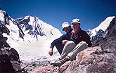
At K2 Base Camp |
Here is the group that made it to K2 Base Camp, at 5,135 meters (16,689 feet). The mountain, at 8,611 meters (27,986 feet) is towering over us. While K2 is the second highest mountain in the world, losing out to Everest by 237 meters, it is well known among climbers as "The Savage Mountain," as it is the far more difficult climb of the two, claiming a high percentage of fatalities among those who try to summit. Climbs of K2 are only attempted by the world's most accomplished mountaineers.
 |
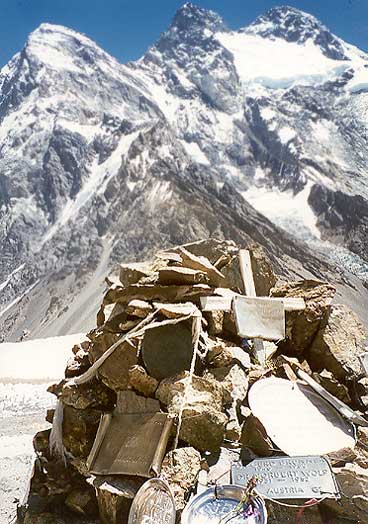
The Gilkey Memorial |
Having said that, there was one detour we had to make from base camp, and that was up to the Gilkey Memorial. This is a sort of shrine that was created by climbers to the people who have died climbing K2.
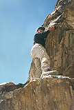 |
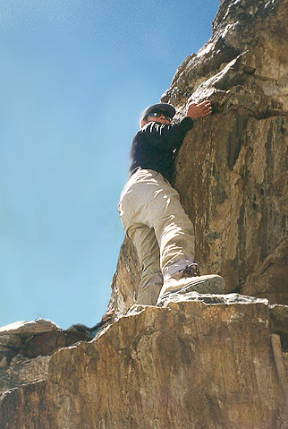
Ledge approaching Gilkey Memorial |
There are plaques with each name put up on a cairn about 100 meters up the side of the mountain, some professionally made, some just a name carved into a metal plate.
It was a steep but short climb up the side of the mountain to the memorial. A small ledge had to be negotiated.
 |
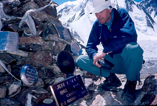
Plaque to Jeff Lakes at Gilkey Memorial |
We saw the plaque to Jeff Lakes that had just been laid down by his family that week -- we had met them on their way back from their pilgrimage to base camp in memory of the climber. He had died in a fateful 1995 expedition that killed Allison Hargreaves, the famous British female climber and five others.
 |
Posing at the Gilkey Memorial |
We all posed for photos on a ledge overlooking Angel Peak behind K2. What you can't immediately tell from the photograph is that there is an enormous drop off just to the left of our feet. As in many other occasions on this trip, it was best not to look down.
 |
The long slog home |
Then it was time to return to Concordia. As exciting and not particularly grueling it seemed to walk to Base Camp, it was particularly unexciting and horribly grueling to walk back. It was an absolutely seemingly endless slog for five hours across more rocks than you can possibly imagine. They were too small to hop on from rock to rock, but too big to ignore. The ice and snow that surrounded us on the way there that kept us cool had, by this hour, melted, so the whole walk back was hot and painful.
But when we finally walked into camp at 5:15 to the cheers of the others, it was sort of worth it all. And we turned around and looked at the magnificent place we had just been that day, and it was truly amazing.
 |
K2 from Concordia |